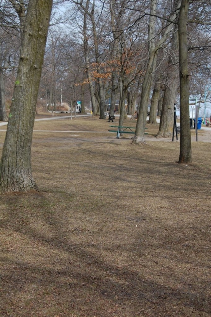
Views of nothing are rarely very interesting. But when they are of a site that once was something, the absence they portray can be noteworthy. Such is the case with this stretch of lakefront park in the vicinity of the Balmy Beach Club. Looking east from the west side of Balsam Avenue, slightly uphill for maybe a hundred metres to the Balmy Beach Club’s lawn bowling green, one is seeing the unfulfilled vision of Balmy Beach community.
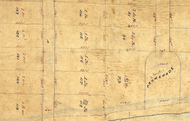
Western waterfront of plan, showing (mostly) one-acre lots west of the subdivision’s private promenade.
The initial subdivision of Balmy Beach, the area between present-day Maclean and Silver Birch Avenues from the lake up to Kingston Road, was carried out in 1876 by Justice Adam Wilson, owner of the vast property – a fact well known to those familiar with the area’s history. (See Sights #1 and #9) What is not known with certainty however, since Wilson left behind no records about this endeavour, is what he was thinking or what he was trying to accomplish.
But the plan of subdivision itself suggests that Wilson had in mind a community of semi-rural seasonal homes for upper-class people like himself because it created building lots of more than an acre – advertised as suitable for villas – as well as a private lakefront “promenade” exclusively for the subdivision’s residents. And it is worth noting that villa communities were cropping up around major cities elsewhere in the world at this time; one had emerged in Canada along the rue de Falaises in the Charlevoix region of Quebec, and Wilson might well have known about this because one of his Toronto legal confreres, William Hume Blake, had a property there and Wilson had himself lived intermittently in Quebec City in the early 1860s. It seems almost certain that Wilson envisioned Balmy Beach as some sort of villa community.
We know with absolute certainty, however, that such a community never materialized. After Wilson died (1891) his business partners and their heirs, responding to the strong demand for housing among the expanding middle class of Edwardian Toronto, shifted strategy and subdivided Wilson’s villa-sized lots down to a size more attractive to the neighbourhood’s builders.
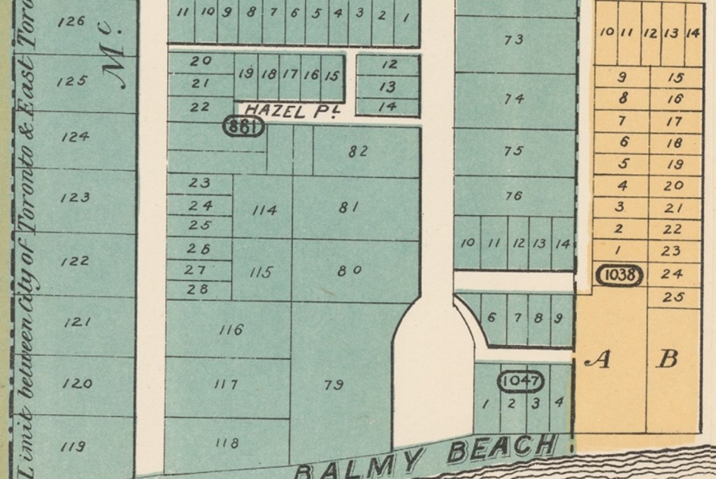
Only about half of Wilson’s original villa-size lots – the lot numbers of which correspond to those in the previous image – remained un-subdivided in 1895 (colours depict municipal jurisdictions).
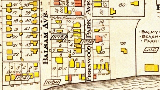
The result was not Wilson’s vision of dispersed villas occupied by well dressed seasonal residents and their servants but, by 1914 if not earlier, a dense urban neighbourhood of modest homes occupied year-round by practically dressed residents who washed their own dishes and clothes. One need only look at Fernwood Park Avenue, where after 1900 the landowner carved out over a dozen small building lots along the boundary between Lots 116, 117, 118 and Lot 79 – visible to this day – to see this strategy manifest.
But in the 1890s, prior to the emergence of this democratized Balmy Beach, a few well-off men and their families, most with personal connections to Wilson, erected substantial cottages along the subdivision’s lakefront. These were not villas, for although spacious they were built of wood, and some lacked substantial foundations. Nor could this be called a community because only a handful of houses were built, and whatever it might be called did not last long because after 1900 the houses became immersed in the new, much denser residential fabric. But for maybe a decade, these summer homes stood as a full-on, albeit miniature, expression of Adam Wilson’s vision for Balmy Beach.
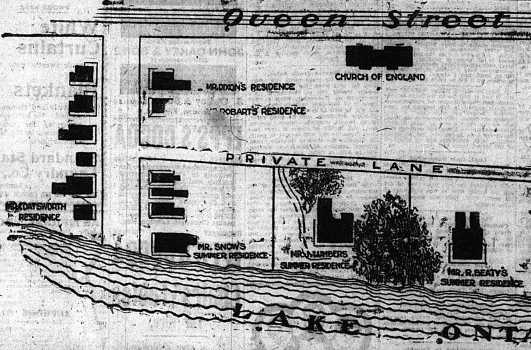
An obviously conceptual ‘map’ from a real-estate advertisement still playing up the area’s exclusive, verdant quality; labels (barely legible here) identify Coatsworth, Snow, Lumbers, and R. Beaty residences.
The most notable, both in terms of who owned them and in how they looked, stood on land west of the subdivision’s central promenade in something of a line along the lakefront of Lots 119, 118, and 79. The furthest west, on the west side of Balsam Avenue where it meets the beach – the point from which the introductory photograph was taken – was a substantial residence built by local politician and developer Emerson Coatsworth (he did not own it for long). Across Balsam, in the middle of a large property a little further from the lake (inaccurately positioned in the advert above), was the plain but capacious cottage of barrister A.J. Russell Snow and his wife Fanny, daughter of James Beaty, one of Wilson’s partners in the Balmy Beach endeavour (and in law practice). Further east, on slightly higher ground just beyond what is now Fernwood Park Avenue, stood Fernwood, an older house and grounds owned in 1900 by the commercial grocer James Lumbers. And a little further east but still west of the promenade stood the three-storey summer house of financier Robert Beaty, brother of James and another of Wilson’s Balmy Beach partners.
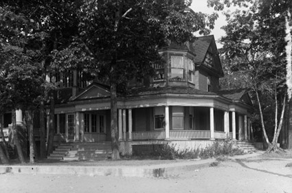
Looking NW at Coatsworth (later Burgess) house 1930, prior to demolition.
All four are gone now, as are Wilson’s own summer house (see Sight #1) and a few substantial waterfront homes east of the promenade. They were demolished in 1931, along with all the cottages that by then lined the beach as far west as Woodbine Avenue, to create Eastern Beaches Waterfront Park (see Sights #2 and #5).
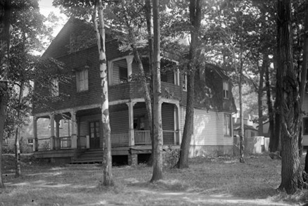
Looking NE at Snow cottage (which faced west) 1930, prior to demolition
Standing here today, it is hard to imagine this now-public lakefront as private property. These fine summer homes would have looked impressive, and no doubt served their owners’ families well, and the air of gentility they imparted likely pleased some nearby residents. But they, and the vision of Balmy Beach they represented, had no place in 1930s Toronto. Here is one element of the neighbourhood’s history that even today’s most ardent preservationists might be glad has vanished.
SOURCES: (in addition to those cited under the images): Blake, Samuel Hume, DCB, Vol. 14; “Sale of Park Lots at Balmy Beach,” The Globe, 7 Sept. 1878, p.6 (villa sales); “Secteur Paysager 7, Chemin des Falaises, La Malbaie, July 2015,” p.7; Registered Plans of Subdivision #881 (1889), #1178 (1895), #1236 (1902), and #1349 (1906) [Ontario Land Registry]; CTA, Toronto Assessment Rolls and East Toronto Assessment Rolls [CTA, Series 749]; Goad’s Atlas 1910, 1913, and 1924, accessed at website ‘oldtorontomaps’; contemporary photograph by author.
